


Start with mapping the five busiest routes by teus and review capacity every few weeks to adjust the next quarter's plan.
Develop understanding of how water congestion, weather windows, and port calls shape transit times and the cost impact, so you can balance capacity across their fleets.
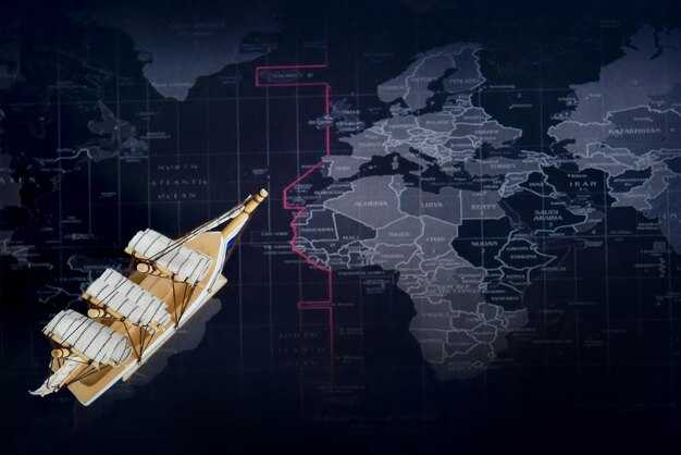
Two corridors dominate global commerce: Asia to Europe and Asia to North America. They funnel through hubs in Singapore, Busan, Shanghai, and through the Suez Canal. Track volumes in teus at these hubs and measure dwell times, vessel speed, and gate queues to keep levels stable as volumes climb. A trend toward higher utilization on Asia–Europe lanes requires tighter planning and smarter resource sharing; plan for cuts in lead times by aligning crews and terminals across weeks.
In Southeast Asia, vietnam stands out as a growing production and consumption node. Ports such as Cat Lai and Hai Phong connect regional supply chains to key routes, boosting export volumes on the China–Vietnam axis and on transpacific arcs. For logisticians, map hinterland connections, container yard density, and ramp-up plans to support higher teus during peak seasons while avoiding bottlenecks in feeder networks.
For long-term resilience, diversify corridors and invest in data sharing, real-time tracking, and collaborative scheduling with carriers and ports. Logistic teams should maintain logistic flexibility, adopt a rolling forecast anchored on seasonality, and satisfy curiosity with scenario tests that simulate disruptions over six to twelve weeks. This approach will improve reliability and cost control across routes and their networks.
To implement quickly, start with a one-page routing map, assign owners for each route, and run a 90-day review cycle to verify gains. This attempt to translate strategy into action will help teams move from planning to results.
10 FAQs about the busiest corridors, port pairs, and navigating global trade networks
-
Q1: Which corridors are the busiest and what does this mean for your economic planning?
Answer: The trans-Pacific corridor from key Asian hubs to the U.S. West Coast is the largest by volume, with Europe-Asia lanes crossing the Suez Canal close behind. These routes handle many exports and imports, shaping rates and reliability across oceans. Real-time vessel data shows peak call windows in late spring and late summer, so book ahead during those periods to avoid late shipments and unnecessary costs. For shippers, this means focusing on backbone routes, balancing line options, and building a smarter routing plan that stabilizes transit times.
-
Q2: Which port pairs carry the most cargo, and how should you choose between them?
Answer: The busiest port pairs include Shanghai–Los Angeles, Ningbo–Los Angeles, Shanghai–Rotterdam, and Singapore–Rotterdam, plus multiple Busan and Shanghai variations feeding U.S. and European markets. When selecting pairs, assess berth productivity, inland connections, and constraint patterns at peak times. If one pair shows rising congestion, try a similar alternative such as Shanghai–Rotterdam or Singapore–Antwerp to keep shipments moving with better predictability.
-
Q3: What metrics should you monitor to protect against disruptions on these corridors?
Answer: Track real-time vessel positions, port call delays, berth occupancy, yard congestion, and dwell times, along with inland transit times and rail or road bottlenecks. Monitor rate trends and fuel costs to forecast total landed costs. A well-tuned dashboard helps you detect shifts early, adjust routing, and maintain stable shipments without sacrificing service levels.
-
Q4: How can you reduce the impact of congestion and late shipments?
Answer: Lock in priority bookings with dependable lines, diversify carriers to avoid single-point risk, and include buffer days in your plans. Use alternate hubs with better throughput during peak periods, and consolidate shipments to reduce coast-to-coast moves. This approach improves reliability, lowers congestion exposure, and keeps exports moving at a steadier pace.
-
Q5: How do routing choices affect fuel use, costs, and CO2 impact?
Answer: Longer, indirect routes increase fuel burn and operating costs, while shorter or more direct options often yield better on-time performance. Slow steaming can cut fuel use, but may extend transit times; weigh this against your service requirements. Consider routing via Cape or Suez based on current prices, congestion, and tankers’ availability to achieve a smarter balance between cost and reliability.
-
Q6: What routing strategies yield the best balance across lines and alliances?
Answer: Adopt a multi-port call strategy that leverages stable schedules from top lines, while maintaining inland access to key markets. Use a mix of direct and feeder services to keep shipments flexible, and rotate among a few trusted alliances to smooth capacity swings. This approach helps you maintain balance between coverage and predictability, especially during volatility.
-
Q7: How can you avoid late deliveries and costly penalties?
Answer: Build a risk plan with real-time alerts on port congestion, weather delays, and equipment shortages. Align orders with carrier schedules that show strong on-time performance, and keep a small contingency stock for critical routes. Proactively adjust routing and port calls to reduce the odds of late shipments and avoid penalties.
-
Q8: How do hinterland links and port efficiency affect route choices?
Answer: Ports with high throughput, automation, and fast inland connections shorten coast-to-market times and improve reliability. Favor hubs with strong rail and road links to major markets to reduce extra days on the coast. Efficient ports amplify the benefits of routing choices and help sustain steady exports and imports.
-
Q9: What role do digital tools and a marketplace play in route planning?
Answer: Digital tools deliver real-time rate comparisons, reliability scores, and carbon footprints across lines and routes. A marketplace approach helps you compare options, model scenarios, and pick the best fit for your shipments and cost targets. Use standardized data to speed decisions and improve outcomes across multiple routes.
-
Q10: What trends will shape the worlds busiest corridors, and what should you do now?
Answer: Expect continuing growth in volumes and tighter competition among lines, with increasing automation at ports and smarter routing through better data sharing. Economic signals point to more options for faster coast-to-coast movements, potential rate volatility, and a push toward greener fuels that can alter fuel costs and CO2 economics. To stay ahead, include scenario planning, diversify lines and ports, and invest in real-time data integration to cut costs, protect margins, and sustain timely shipments as global demand grows.
Key corridors by volume and capacity
Prioritize investments in the Asia–North America lanes and the Asia–Europe lanes this year to raise throughput and reduce dwell times; deepen port capacity, enhance hinterland links, and deploy real-time information systems to boost visibility.
Across the global network, the Asia–North America and Asia–Europe lanes carry the most volume, handling tens of millions of teus annually. This growth reflects shifts in manufacturing and consumption, with america and canada gateways acting as critical nodes for hinterland flows. Another major artery is the Europe–Mediterranean corridor, which supplements growth on Atlantic routes. Despite this seasonality, volumes remain resilient. In several legs, the figure tops a million teus annually.
Many shippers use the spot market to adjust to demand signals; improved multimodal links connect ports to inland terminals for faster moving goods. Freightmango analyses show that multimodal links yield more reliable schedules and lower dwell times.
Ships on the busiest corridors deploy higher-capacity tonnage, but port depth, crane capability, and rail/road hinterland connections must increase. This reality also creates increased backlogs, so operators must adapt to them with faster onboarding and flexible slotting across lanes and regions.
To translate traffic growth into reliable service, map corridors by teus and year, expand information sharing across operators, and pilot dynamic slot allocation and pricing. Target near-term wins on the canada–america axis, then scale to other regions as multimodal goods move faster year over year.
Chokepoints and their impact on schedules
Implement a dynamic routing plan that buffers 4–7 days around chokepoints like Suez, the Malacca Strait, and the Panama Canal to reduce shipping delays. Coordinate with carriers to balance modes (shipping, rail, and trucking where available) and align sailing windows with expected queues. Carriers should adjust sequencing to improve reliability for trade partners and clients. Maintain just a small buffer to absorb delays, and review contracts to handle surcharges when queues lengthen.
Chokepoints trigger schedule drift by extending the time between departures and arrivals. Queues form, vessels bunch, and the chain experiences ripple effects across ports and hinterland connections. Overcapacity worsens delays when demand outpaces slot availability. Surcharges rise as carriers recover added dwell time, so include these costs in client negotiations. Tariff changes can alter flow and demand signals; for peru-origin trade, pre-book slots and consider alternate hubs to reduce exposure. Maintain just a small buffer to absorb delays.
Global bottlenecks and corridor specifics: Suez Canal transits account for about 12% of global seaborne trade; the Malacca Strait moves roughly 25–40% of world trade and up to 80% of Asia–Europe trade, illustrating why queues here ripple into long routes and shift direction of travel across major lanes. Understanding these numbers helps supply teams plan more accurately and provides clients with visibility on teus, volume, goods, and schedule risk. asian lanes, including vietnam-bound goods, demand disciplined pacing and diversified routing.
Practical steps for asian and Americas corridors: for vietnam-origin shipments, build multi-route options to avoid single chokepoints; for peru shipments, pre-book slots well in advance and use alternative hubs to bypass potential Suez delays. Use multi-modal legs to reduce canal exposure; include tariff clauses and keep surcharges manageable when queues spike. Adjust plans monthly based on port stay times and canal advisories to keep service levels steady.
Dominant port pairs and hub dynamics
Focus smarter routing around those dominant port pairs to keep cargo moving and reduce weeks of idle time. The strongest anchors are Shanghai–Rotterdam, Singapore–Los Angeles, Busan–Long Beach, and Ningbo‑Zhoushan–Antwerp corridors, which process high-throughput traffic and support high, reliable routing throughout. Shanghai handles about 50 million TEU per year, Singapore around 37–38 million, Ningbo‑Zhoushan roughly 34 million, Busan near 28–29 million, while Rotterdam sits near 14–15 million and Los Angeles/Long Beach combined approach 18–20 million. Those routes connect production points with end markets, providing coverage across oceans and sustaining container transport.
Hub dynamics drive shifts in routing and capacity. When three to four hubs anchor a loop, carriers connect dozens of feeder lines and schedule back-to-back calls, smoothing exports and imports while reducing exposure to declines on any single leg. For a given carrier, this pattern helps optimize its schedule and yields much more predictable earnings on the high-volume Asia–Europe and Asia–North America corridors, while lowering overall risk for operators and enabling smarter asset utilization. The port calls at a chosen hub set the benchmark for schedules, and a single delay can ripple across routes.
The water routes across oceans still shape scheduling. Tankers carry energy exports and feed crude and product trade, and those flows could ripple into container freights. When disruptions arise in key lanes such as Suez or Hormuz, planners shift cargo toward alternative routes, and those shifts are seen in charter rates, insurance costs, and the timing of port calls.
Balance across gateways reduces risk. A diversified hub set keeps shipments flowing, throughout the network, even during congestion, with alternative routes ready to pick up volume as weeks pass. This approach supports higher vessel utilization and steadier throughput for both containerized goods and related logistics services.
Practical steps include mapping dominant port pairs, tracking port dwell times, and aligning feeder connections with rail and road links. Target explicit balance between exports and imports, invest in data-driven routing tools, and monitor shifts in earnings signals to reallocate capacity quickly. The ultimate aim is to keep much of the traffic moving on those high-value routes and to preserve smarter connectivity for goods throughout the trade lanes.
Vessel types and schedule patterns along main lanes
Adopt a diversified fleet with a higher share of Ultra Large Container Vessels on transpacific and other high-volume routes, while keeping Panamax and feeder ships for intra-asia and shorter hops. This mix will tighten the supply chain, reduce ballast days, boost earnings, and deliver savings across the container network.
On transpacific routes, Ultra Large Container Vessels in the 14k–24k TEU class dominate the coast-to-coast flow, with container ships calling primarily at america west coast ports and then intermodal hubs inland. Typical speeds of 16–20 knots keep total transit under 20 days for many shipments and support reliable scheduling for customers along the coast. This pattern provides predictable routing and helps maintain higher service levels across the chain.
Asia–Europe and transatlantic lanes rely on New/Post-Panamax tonnage for long-haul lanes, with voyage times around 28–35 days and port rotations through Singapore, Suez, and Rotterdam. These routes reach peak utilization when sailings run with regular intervals, yet canal delays and weather risks require buffers to keep shipments moving and avoid costly backhauls. freightmango analytics show that the right mix of ships on these routes raises savings by avoiding unnecessary ballast and reducing idle capacity.
Intra-asia lanes operate with high frequency and short hops, with mainline services cycling every 2–4 days on key corridors linking China, Japan, Korea, Southeast Asia, and the Indian subcontinent. Feeder networks connect hubs to smaller ports, keeping coast-to-coast transit times tight for many shipments and sustaining rapid turnaround on container moves. Operators report lower dwell times and higher asset utilization across intra-asia operations.
Scheduling patterns center on fixed rotations, direct hub-to-hub services, and short port stays to prevent dwell time from eroding earnings. Port congestion, canal disruptions, or weather events raise risks to timing, but predictable routing and buffer days keep the chain resilient. In disruptions, operators rebook quickly, preserving service quality and protecting container flow across worlds routes and markets; this approach remains a core advantage of global lanes.
November demand surges underscore the value of aligned vessel types and schedules. freightmango data shows higher container utilization and stronger earnings during the peak season, reinforcing the economic case for planned routing, regular shipments, and consistent container counts. By tracking container yield, companies can optimize the chain, reduce empty legs, and capture ongoing savings across the worlds network and across america and asia trade lanes. The pattern of ongoing shipments builds a robust corridor map for future growth.
Disruption mitigation and resilience strategies for routes
Set up dynamic scheduling and buffer inventories to cut delays on core routes. The need to protect shipments rises during peak month periods and holidays, when demand spikes on trans-pacific lanes and other busy corridors. Implement a rolling safety stock of 2-4 weeks for high-volume products in key regional hubs to absorb short-term shocks. Maintain cross-branch visibility to track containers throughout the network, enabling faster rerouting if a port delays ships or a weather event blocks water access, which prompts quicker adjustments.
Build a regional hub network to reduce reliance on a single port. Within america and nearby countries, designate 3-4 anchor lanes and pre-stage containers at inland depots to shorten backhaul times. By prepositioning shipments, you jump between ports with less risk and improve access to inland markets, especially when holidays spike volumes. This approach helps avoid overcapacity on peak weeks and supports a smoother flow across the lane.
Connect key routes with alternative corridors to spread risk. Include short-haul feeder routes and longer trans-pacific segments to balance load, so a disruption in one waterway does not stall all shipments. In practice, this means maintaining two or more routes for critical lanes that connect china and america, plus regional lanes that pass through multiple countries, enabling faster reroutes around a port closure or weather event.
Leverage data analytics and collaboration to reduce response time. Track the average delay per port, vessel, and lane, and share alerts across carriers, freight forwarders, and authorities. A proactive stance shortens disruption duration, improves access to capacity, and lowers the need for last-minute bookings. When a disruption occurs during the month-end peak, unified information helps save days of idle time and yields measurable savings.
| Action | Region / Route | Key Metric | Expected Benefit |
|---|---|---|---|
| Dynamic scheduling and buffer stock | Trans-pacific and regional lanes | Lead time variability | Delays reduced by 15-30%; more reliable shipments |
| Regional hub pre-positioning | america and nearby markets | Container dwell time | Lower congestion impact; savings in transit time |
| Diversified routes and inland access | Global lanes | Overcapacity risk | Load balancing; higher resilience |
| Real-time data sharing | Cross-border | Alert latency | Quicker rerouting; fewer missed shipments |