


Recommendation: lock in multi-month contracts with alternative carriers and diversify gateways to blunt the impact of escalating delays. entering the peak retail window, international flows have tightened: the scfi index last month climbed above 1,400 points, and dwell times at major logistics hubs have lengthened by 10–14 days, affecting multiple lanes and container movements. Scenario modeling helps teams quantify exposure and set guardrails.
The toolkit includes a list of five bottlenecks, a clear checklist: identify the top five bottlenecks, reoptimize routing, and negotiate terms that cap unexpected charges. before you expand schedules, model the cost impact of longer dwell times on your cargo calendar, including additional costs, and align with retailers on delivery windows.
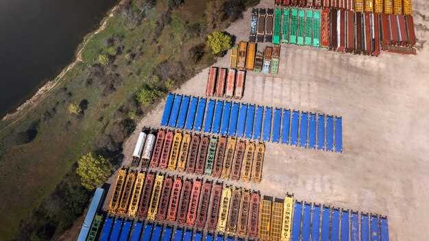
Multiple lanes show pressure: container availability is tighter than in the last quarter. The list of action items includes reserving space earlier, consolidating shipments, and shifting to less congested corridors. If you are moving multiple SKUs, group them into fewer containers and plan last-minute conversions to fewer container loads where possible. Charges above the baseline will apply, so plan for contingencies and carry additional costs in your budgets. These steps are designed to expand capacity across gateways and operations.
Actions taken by operators include expanding yard capacity and adding measures to expand gateway options, as well as extending operating hours at terminal hubs, and increasing the use of cross-country rail to bypass troubled segments. These steps are designed to operate longer schedules without sacrificing service levels, yet they require upfront capital and careful coordination with retailers and distributors.
Before locking in new routes, run a scenario committed to cash flows: baseline, best-case, and adverse-case. The scenario should cover scfi spikes, container surcharges, and potential weekend shortages. Retail planners should use a contingency plan that relies on multiple entry points and a real-time data feed to avoid surprises.
With additional buffer stocks and a rolling forecast, the plan can reduce the risk to supply continuity for those channels that serve brick-and-mortar and online retailers.
Only disciplined budgeting and a tight list of priorities can keep margins intact: prioritize lines with the highest contribution, and defer optional orders until the congestion eases.
Asked by executives for clarity, the plan should spell out key metrics: on-time delivery rate, dwell time, container utilization, and landed cost per SKU.
In practice, supply teams should maintain a running list of approved lanes, monitor the scfi index weekly, and renegotiate terms when signs point to further tightening. The aim is to keep retail readiness intact while keeping a lid on charges and preserving margins across multiple channels.
Geographic scope: ports, corridors, and countries covered
Recommendation: Establish a regional data framework that maps arrival points, major corridors, and supplier countries, then assign dedicated monitoring teams and feeds to capture statistics every quarter; prioritize Pacific and East corridors with five hubs first, then expand to others as capacity grows.
Many inbound shipments flow through concentrated hubs, then arriving volumes reveal chronic bottlenecks. The realization is that a small number of routes drive most delays, and given current patterns, targeted interventions can yield measurable gains. During the period, charges associated with overload and handling have increased by single-digit to low-double-digit percentages in peak windows, signaling the need for rapid action.
Key corridors and hubs
Across the Pacific and East corridors, the main hubs handle the majority of arriving cargo, with statistics indicating that the top five nodes account for about 60%–70% of throughput. Approaches include technology-enabled tracking and the application of real-time visibility to truck movements and retail supply chains; journal articles and other sources confirm that improved data exchange reduces cycle times and lowers costs. Operators can implement two parallel tracks: data standardization and automated alerts, then expand to a third track for predictive analytics. This is possible with consistent data feeds and cross-border cooperation.
Country coverage and data sources
The geographic scope extends to ten economies in the two primary lanes, with others added as data matures. Given the period, Asia and the Americas account for the lion’s share of goods arriving, and the importance of cross-border collaboration grows. The percentage distribution shows Asia contributing most arrivals, followed by North and South America, with others making up the remainder. This dispersion informs where charges can be reduced via coordinated schedules and trucking logistics, including increased use of rail and intermodal options. The application of these approaches relies on technology, standardized data formats, and continuous reporting from operators and retailers, with sources ranging from company disclosures to industry journals.
Data sources and coverage: authorities, AIS, terminals, and private providers
Recommendation: adopt a demo-ready, unified data-sharing agreement by october that combines authorities, AIS, terminal schedules, and private provider feeds to guarantee accurate monthly coverage and faster, direct decision-making.
Authorities and regulatory bodies provide the authoritative baseline: vessel movements, entries, and unloading confirmations, forming the backbone of the entire dataset. AIS delivers near real-time positions, heading, speed, and vessel identity; when merged with terminal calendars, this yields direct visibility into ETA, ETD, and potential slowdowns in the shipping cycle.
Private providers fill unfilled gaps by delivering satellite AIS, enhanced metadata, and alternative feeds, lifting accuracy across the entire network. The combined includes data from york-area terminals and key ocean lanes, boosting confidence in planning and reducing reactive labor. In july, the integrated feed reached the highest accuracy for major corridors; the october demo showed a meaningful uptick in the percentage of events captured within a two-hour window, underscoring the value of a multi-source approach.
Data streams and reliability
The data includes official movements, AIS positions, heading, and velocity, plus terminal schedules and unloading plans. Monthly updates align fields such as vessel name, voyage number, movement status, ETA, ETD, and loading/unloading events, enabling accurate comparisons across sources. Such alignment supports direct control of sequencing, reduces wait times, and strengthens the ability to drive decisions at the ocean-front line.
Coverage details matter: authority feeds anchor the baseline, AIS adds real-time texture, terminals provide scheduled visibility, and private providers fill the unfilled gaps with satellite feeds. This mix sharply improves the overall completeness, with a near-elastic reach into high-activity lanes and the slower corridors, delivering an accurate view of the entire shipping window.
Gaps, costs, and implementation timeline
Gaps remain in smaller hubs where data feeds are sparse; the plan is to close these by layering private feeds and targeted terminal feeds. Costs for private data vary by vendor and cadence, but monthly amounts are typically offset by a reduction in wait times and fewer manual reconciliations, yielding a favorable percentage improvement in operational visibility.
Implementation follows a staged path: start with a october demo in a core network, scale through november–january, and target full coverage by july next year. The agreement should specify data fields, update cadence, and quality metrics, plus a rolling review to keep data aligned with evolving shipping patterns. Such governance translates into cleaner workflows, shorter unloading windows, and a more reliable monthly picture for executives and planners alike.
Temporal coverage: update frequency, latency, and data freshness
Adopt a rolling, extended update cadence with a strict latency ceiling to keep customers informed. Target end-to-end visibility for overseas logistics events within 60 minutes of occurrence; provide nearly real-time updates at a 30-minute cadence for shipping schedules, with a 6-hour window for settlement data.
Segment cadences by data category: shipping schedules and vessel calls every 15 minutes during the busiest, scheduled months; on-ground status of trucks and chassis every 30 minutes; settlement and invoicing events every 6 hours. This keeps operators and customers aligned with near-real-time changes, without flooding feeds with redundant records, and improves decision-making.
Measure latency with defined SLAs and data freshness windows. Maintain a full audit trail with timestamps, data age, and last update moment; target data freshness at or below one hour for fastest corridors, and under four hours for longer routes. Levels of staleness are monitored; if a feed is dropped, automated refresh cycles kick in to restore visibility.
In stress scenarios, such as Suez-channel disruptions threaten extended delays or pandemic-driven harbor slowdowns, extend data coverage and pre-stage alerts. Also, the administration should publish guidance on data-sharing commitments to owners and operators. Ensure copyright notices and data provenance are clear to maintain trust; rehearsals show a possible path to keep shipments visible during elevated flux.
Coordinate with calendar milestones, such as March settlement cycles, to trigger pre-briefs for customers and overseas partners ahead of invoicing windows and shipment scheduling. This minimizes surprise gaps and supports full planning coverage across time zones and shipping lanes.
Commodity-level coverage: which agricultural products are included and where gaps remain
Recommendation: Implement a daily commodity-level mapping and lock in alternative routes to cut berthing delays in Francisco and York; this reduces the time to move shipments and minimizes shortages. Place near-term priority on corn, soybeans, and wheat, given their annual demand and sharp movement; track using at least three sources; calculated exposure helps avoid over-commitment into any single corridor. Favor zero-emissions transport options where feasible to lower burden on networks and warehouses. Use news signals and technology-enabled dashboards to improve position for industries and involved parties.
Included commodities and current coverage
- Grains and cereals: wheat, corn, rice, barley, oats. Coverage: annual movement in the hundreds of millions of tons; number of routes tracked ~7–9; sources include customs data, carrier schedules, and factory inputs. Gaps: southern hemisphere shipments and some minor routes lack real-time visibility, making some time-sensitive decisions unable; prior-year trends show a sharp change that is not yet reflected. Action: add two additional sources and align berthing windows to reduce delays; data cleared through customs and tracking are needed to reduce the burden on shippers and industries.
- Oilseeds and pulses: soybeans, canola, sunflower seeds, flax. Coverage: strong in North America and Brazil; annual movement around 120–160 million tons. Gaps: Japan demand signals not fully integrated; other Asian markets underrepresented. Action: add Japan-specific sources, cross-check with EU data; track movement by shipper and route to improve tracks and timing, among others; this gives better position to plan inventory.
- Dairy and protein products: milk powder, cheese, butter, beef, pork. Coverage: high in Europe and the Americas; involved factories number exceeds 1,000. Gaps: Asia and Africa data coverage weaker; berthing delays at major hubs affect distribution to retailers. Action: expand data feeds from facilities and suppliers; use movement tracks to anticipate shortages and adjust orders. This data helps industries respond faster to demand changes.
- Fruits, vegetables, and edible oils: apples, citrus, bananas, tomatoes, grapes. Coverage: moderate; seasonal patterns drive peaks. Gaps: perishable goods require greater granularity; movement in Francisco and New York corridors is slower, increasing the risk of losses. Action: add weather and harvest calendars; improve sources and tracks for per-route visibility; monitor demand spikes in Japan and Europe; ensure shipments can be cleared in time to meet peaks.
- Processed ingredients and fibers: sugar (sucrose), cotton lint. Coverage: moderate; gaps: data for some minor-origin belts. Action: aggregate signals from mills, spinners, and traders; tracks improved via additional sources. This helps industries keep production lines running smoothly.
Gaps and quick fixes
- Regions around North America and Europe: data covers major commodities but misses detail on smaller corridors; recommendation: add three more sources and cross-check with factory feeds to improve timing. This fixes the burden on shippers and helps keep position aligned with prior forecasts.
- Asia-Pacific and Japan: demand signals underrepresented; recommendation: establish direct feeds from regional distributors and terminals; track movement of key commodities with higher frequency; monitor berthing delays in Francisco and other hubs; this narrows the time to clear goods and reduces shortages.
- Shippers and factories: ensure alignment with the annual schedule; more than one source needed to avoid a single failure; implement technology to track movement in near real time; among the actions, ensure that data is cleared and available to all involved parties; this supports the position of each stakeholder and helps manage shortages.
Regional gaps and biases: impact on uncertainty assessment for exporters and policy makers
Recommendation: expand multiple data streams and formalize an agreement across agencies to share a common baseline. Use this to map movement by ship, land routes, and railroad corridors, and to align inputs from carriers, retailers, customers, and operators. Establish a public dashboard that highlights on-time performance and capacity gaps above forecast levels; back this work with dedicated funding from the administration. Further, establish a feedback loop with field operators, black ranchers, and local retailers to continuously refine the model.
Data gaps by region
Regional biases emerge in three areas: data lags by region, narrow inputs from main corridors, and stakeholder blind spots. The east region shows leading dependence on a small set of carriers and the primary railroad spine, while other regions rely on broader networks. Independently collected indicators and a closed list of performance metrics reveal otherwise hidden variability, especially for ranchers, black producers, and land-based shippers. By expanding the baseline with inputs from ranchers, retailers, and customers, this process is giving insights into how the main routes perform under multiple demand swings and across movement patterns.
Policy actions to align assessments
To close biases, policymakers should implement concrete steps: publish a standard list of metrics, fund independent surveys, and require all operators to report performance along key corridors. Expand data sharing between administration units and private sector players; ensure a baseline dataset covers east, midwest, south, and western gateways. This helps retailers and customers make informed decisions and expands visible movement patterns, reducing exposure for under-served communities such as black ranchers back on small holdings. Otherwise, allocation will miss buying power and create blind spots for multiple buyers. A winning approach–combining public data with private signals–strengthens resilience.