


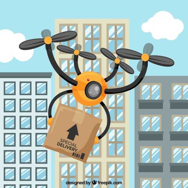
Adopt drone delivery for last-mile logistics in urban zones now to lift efficiency and reduce operating costs. Leading platforms report higher on-time rates, faster inventories, and measurable gains: efficiency up 25-35% and delivery times shortened by as much as 30% in dense markets. For urgent deliveries such as vaccines, drones can reach customers within minutes of dispatch, especially in residential neighborhoods where traditional routes often struggle.
However, this ascent introduces risks and issues that demand careful design. Battery endurance and payload constraints limit range; typical urban drones carry 0.5–2.0 kg for 15–30 minutes in windy conditions, with last-mile hops targeting short routes. Material quality of packaging matters: lightweight, shock-absorbent cases protect fragile items. Urban weather, airspace rules, and traffic in the skies create regulatory complexity that operators must map before scaling. In healthcare corridors, ensuring cold-chain integrity for vaccines adds another layer of constraint.
To reduce these issues and improve safety, invest in platforms with redundancy, robust navigation, and geofencing. Use weather-aware routing, battery thermal management, and secure data handling to protect customers and comply with privacy rules. Regular maintenance and drift testing help keep battery performance predictable across shifts and seasons.
In dense urban cores, operations must balance speed with community trust. Clear communications with residents about drone corridors, noise, and privacy reduces friction, while reserved residential slots enable predictable service. For customers, visible improvements in delivery windows build confidence and loyalty; for urban planners, transparent reporting in a journal helps track progress and safety metrics.
According to an industry journal, fleets using modular platforms that scale with payloads and battery sizes report higher throughput. A typical route mix shows a 20-40% reduction in vehicle traffic and lower urban congestion. Operators partnering with uber-style micro-fulfillment hubs push deliveries closer to customers, reducing last-mile waste and boosting satisfaction.
To implement quickly, leaders should pilot in controlled urban districts before scaling to residential areas; set clear KPIs: on-time rate above 95%, mean delivery time under 20 minutes for intra-city hops, and a documented safety incident rate under 0.01 per 1,000 flights. Maintain a transparent log in a dedicated journal to share learnings and outcomes with regulators and customers.
Overcoming the Obstacles: Challenges and Practical Solutions
Start with a targeted urban pilot in high-density districts to validate flow and speeds, then scale by building shared hubs and integrating with ground logistics. This phased approach lets operators map rooftop-to-hub routes, track delivery times, and confirm battery swap cycles before committing a million dollars in capex. Look for patterns in times of day and weather windows to refine routes and avoid unnecessary expenditures.
Highlighted challenges include urban airspace governance, weather constraints, and the density of buildings. In ghana, traffic patterns and the rainy season narrow flight windows, complicating schedules across residential blocks and high-rise corridors. Safety measures such as collision avoidance, robust geofencing, and reliable comms with ground crews must accompany every test.
Practical solutions center on three pillars: 1) deploy 3–5 micro-hubs across the city and install rooftop pads onto densely built high-rise and residential buildings so drones can land onto reliable ground points; 2) pair aerial routes with ground support from e-bikes to finish the last mile, using a mixed fleet to spreads risk; 3) pursue integration with existing parcel networks rather than purchasing a full fleet upfront, leveraging leasing or shared assets to scale gradually.
Operational data from early pilots show meaningful gains. Deliveries per week rose to about 2,400 in test zones, while average door-to-door times dropped from roughly 45 minutes to 12–15 minutes in clear weather windows. Energy costs per delivery declined by a third as modular batteries and fast swaps improved flow, and the market across urban cores became largely receptive to this last-mile option, especially where access to residential blocks is limited by dense layouts and confined ground space.
To move forward, establish clear governance with local authorities, map access corridors across hubs, and tie performance metrics to service level agreements. Build dashboards that track times, speeds, and reliability, then iterate on route planning and ground handoffs. Prioritize data-sharing with buildings and property managers to secure landing pads and ensure consistent operation, while keeping a vigilant eye on safety and community impact during peak hours.
Which parts of the supply chain benefit most from drone delivery?
Directly prioritize last-mile and urgent replenishment with drones, focusing on stores, clinics, and field depots in urban cores and remote pockets where delays bite.
These gains come from three core scenarios: the final leg to storefront or customer, urgent replenishment of high-demand items, and rapid equipment delivery to service teams. Past pilots show that, on routes under 15 km, flying directly over congestion reduces transit times by 20-40%, and in dense centers the delta is even larger. Look at the data across times of day and demand spikes to see where the impact is strongest.
Healthcare, pharmacy, and industrial service networks benefit from clear authorization and coordinated flight plans. By collaborating with agencies and using trusted platforms, teams cut administrative delays and meet tight service-level targets. These platforms keep stakeholders updated with flight plans, weather windows, and status changes, reducing the risk of missed slots or accidents.
Inside warehouses, drones equipped with cameras and sensors speed inventory checks, shelf readiness, and automatic stock verification. A compact fleet can scan aisles, verify counts, and flag discrepancies for human agents, reducing cycle times and freeing staff for higher-value tasks. These operations rely on platforms and equipment already in use, and they feed data back into the planning loop to improve demand signals.
Beyond storefronts, drones serve offshore platforms, rural clinics, and disaster zones, taking the load off ground teams and keeping supply lines open when roads are impassable. These missions directly reduce delays for essential parts, medical supplies, and field tools, improving uptime for operators and easing logistics pressure on the industry.
Limitations remain: payload constraints, weather windows, and airspace rules. To solve these, operators combine multiple lightweight platforms, swap payloads quickly, and build pre-approved routes with authorities. Regular survey cycles with agencies and industry partners identify risks and safety improvements. A disciplined risk assessment helps teams minimize accident potential and keep operations running.
A practical rollout plan starts with a three-zone test: urban store-to-consumer, regional urgent-parts delivery, and a warehouse internal scanning program. In each zone, involve parties across departments and with third-party providers to test capabilities. Clear handoffs between stores and third-party operators help them stay aligned. Track metrics such as on-time delivery, flight-hour utilization, and inventory accuracy to prove ROI over a 12- to 18-month horizon. Maintain keen attention to authorization cycles, platform uptime, and stakeholder feedback from customers and staff.
Over the long-term, integrate drone logistics with existing platforms so that demand signals and shipments align automatically. The ascent will require ongoing data sharing with agencies and continuous equipment upgrades, but the payoff is lower delays, fewer capacity bottlenecks, and a broader ability to solve friction across the industry.
How to integrate drone operations with existing warehouses and fleets
Define zones for takeoff, transit, and landing, and align them with warehouse layout and fleet schedules to minimize handoffs. This approach is likely to cut cycle times and fuel use.
Create a lightweight integration layer that lets the drone wing and the warehouse management system (WMS) share status and orders with the fleet software, enabling related workflows to synchronize in real time.
Adopt uber collaboration patterns across the delivery and warehouse teams.
Launch a proposed pilot project with 2-3 drones, 3 zones, and 2 deliveries per hour to validate timing, energy use, and maintenance routines.
During conducting this stage, focus on safe flight planning, geofencing, and payload constraints to prevent interference with humans and equipment.
Set up a lightweight policy that respects security and privacy while enabling related systems to align on orders and inventory movements across zones.
Use a simple scorecard to compare delivery speed, on-time rate, and fleet utilization; use this to inform expansion decisions to additional zones.
Generally, these steps deliver clearer governance of zone operations and help balance automated and human tasks.
| アスペクト | Recommendation | メトリクス |
|---|---|---|
| Zones and routing | Define zones and connect to dock/pick paths; maintain a wing-friendly footprint | Delivery cycle time; on-time deliveries |
| システムインテグレーション | Implement an uber-style coordination layer linking drone wing, WMS, and fleet software | Sync latency; integration uptime |
| Pilot project scope | 2-3 drones, 3 zones, 2 deliveries/hour | Deliveries/hour; drone availability |
| Safety and compliance | Geofencing, payload limits, secure hand-offs | Incident rate; payload integrity |
What regulatory hurdles apply and how to handle them?
Begin with a regulatory readiness map for your route and secure the necessary waivers before scaling.
The regulatory ecosystem for drone delivery spans multiple jurisdictions. It demands a clear safety case, a privacy plan, and a property-rights strategy. The landscape shifts rapidly, and the number of required documents grows with each new corridor. Build a living dossier that you review quarterly and keep accessible on-line for authorities and community stakeholders.
A goethe-inspired question about duty and responsibility toward bystanders and property owners helps frame the risk assessment. Use a single information package, aggregated from field tests, design reviews, and sensor data from lidar and other instruments, and submit it via on-line portals.
- Jurisdictional gateways
- switzerland: Federal Office of Civil Aviation (BAZL) governs drone operations; BVLOS waivers require a risk assessment and a defined safety case; local pilot zones and corridors must be approved.
- finland: Traficom aligns with EU rules; operator certification, remote pilot requirements, and Specific/SORA-based approvals under EU UAS rules.
- EU-wide: EASA categories Open, Specific, Certified; for road-based urban routes, plan under Specific or BVLOS with SORA; time windows and altitude limits typically apply.
- Operational constraints and route design
- Start with line-of-sight operations in the Open category and expand to BVLOS only after risk reductions and approved corridors.
- Define route segments around densely populated areas, garden zones, and footprint around private property; avoid prolonged flight over private property without consent.
- Choose corridors that minimize traffic conflicts and avoid wind shear zones; plan for winds and gusts with conservative margins.
- Safety, privacy, and property
- Obtain property rights clearances and neighbor consent near the route; post-flight notifications and signage around critical points.
- Implement data governance for information collected from cameras and sensors; apply privacy-by-design and minimize the footprint of data collection.
- Document maintenance schedules, pilot qualifications, and airworthiness records; maintain a visible safety case for authorities.
- Technology and data requirements
- Use lidar and other sensors to detect obstacles and ground risk; ensure fail-safe geofencing and remote-id compliance.
- Store flight logs and telemetry on-line with tamper-evident protections; provide access to authorities when requested.
- Limit data sharing to essential information and ensure secure channels for information exchange.
- Community and ecosystem engagement
- Engage with local residents and garden associations to explain benefits and address concerns; share a public information package (in English and local languages if needed).
- Coordinate with multiple companies operating in the same corridor to align traffic management and not overload airspace.
Implementation timeline and practical steps
- Inventory all required permits in switzerland, finland, and EU-wide rules; catalogue them in one master file.
- Develop a SORA-based safety case for BVLOS where needed; simulate packages moving along route during peak traffic periods.
- Set up on-line permit submissions; create dashboards for regulators, customers, and community partners.
- Launch a controlled pilot with a small footprint near a garden corridor, using lidar for obstacle detection and low-speed operations.
- Review feedback from authorities and adjust routes, flight levels, and privacy measures accordingly.
What safety standards and risk controls ensure reliable service?
Adopt a unified safety framework that binds certification, flight planning, and maintenance to deliver reliable service. Introduce a formal process for operator training and routine audits, and lean on intelligence from flight data to detect anomalies.
Define operational requirements for hubs and aerial corridors, and require BVLOS readiness with sense-and-avoid, remote identification, and geofencing. Specify where each flight may operate, whether the flight is urban or rural.
Risk controls hinge on a multi-layer risk assessment for each mission, with a hazard journal to record events and learning. Apply multiple redundancy paths for critical systems: propulsion, navigation, and communications. Require automated safety alerts and preflight checks.
Implementation plan uses a staged rollout: paris project using matternet technologies, then expand to finland and ireland to support homes, relief, and small business deliveries. Measure outcomes with clear marketing indicators and community feedback.
Operational metrics track lands accuracy, success rate, and problem events; maintain a living log in a journal for continuous improvement. Use data feeds to update risk controls and the process.
Projected growth informs long-term capacity planning and the placement of new hubs. Design weather-resilient platforms, robust batteries, and modular software updates. Use intelligence from multiple sources to optimize routes in real time and reduce risks. Maintain transparent reporting to stakeholders and customers.
How to assess cost, timing, and ROI for a pilot project
Recommendation: run a four-week pilot on a single route with two drones and one operator pair. The system delivers packages to customers on a predictable cadence; track attempts to complete each delivery, flight time, energy use, and ground-handling tasks to feed an economics-based model. Establish early benchmarks for cost per delivery and time savings to set targets and make a credible business case.
Costs to capture include equipment (drones, batteries, payload boxes, landing pads), spare parts, maintenance, insurance, licenses, and ground-control software. Add ground-crew labor, per-flight charges if you rely on a service, charging hardware, and contingency for weather or regulatory changes. Break out upfront capex and ongoing opex to show unit economics clearly; document a need for a predictable budget and contingencies for scale.
Timing and readiness: map the route window, define loading and unloading steps, takeoff and landing times, and safety checks. Establish emerging methods to test throughput under growing demand; run controlled tests to validate assumptions about quicker deliveries and customer convenience. Confirm interoperability of equipment with landing pads and charging infrastructure; ensure data feeds from the flight controller integrate with your operations, and set early milestones for crew training and SOPs.
ROI model: translate time savings into dollars by comparing drone delivery against ground transportation. Include carbon savings per mile and factor in potential revenue uplift from promotional campaigns tied to the pilot. Use some scenario planning (low, mid, high growth) to show ranges; calculate ROI as net benefits minus costs, divided by costs, and highlight leading indicators such as on-time rate and cost per delivery to guide decisions.
Data to collect: flight times per leg, total delivery count, attempts per drop, on-time rate, maintenance cycles, battery cycles, incidents (including crash) and safety events. Use a simple dashboard to highlight highlighted metrics for leadership and track them alongside customer feedback on convenience and reliability; this helps them understand the value of the initiative and where to invest next.
Decision points: set go/no-go thresholds for cost per delivery, uptime, safety incidents, and ROI milestones. If results meet targets, expand to additional routes and pads, adjust equipment mix, and increase charging capacity. Use the pilot to make a scalable business case and accelerate adoption of drone delivery across the network.