

 Beyond the Hype – How Drones Are Really Improving Value Chains">

Begin met een gerichte periode van 90 dagen piloot bij één inbound distributiecentrum: implementeren autonomous drones uitgerust met rfid lezers om pallets te scannen tijdens het lossen, waardoor uw transport gegevens in uw WMS en ERP. Dit addition kan de doorlooptijd van ontvangst tot opslag met 25-40% verkorten en de inventarisnauwkeurigheid in het eerste kwartaal verhogen van 95% naar 99%, waardoor de company om dezelfde resultaten op andere sites te repliceren.
Define a project met een duidelijke approach en meetbare KPI's, waardoor drone-acties worden afgestemd op uw bestaande processes en IT-gegevensstromen. Naast proefprojecten, focus op het implementeren van tijdlijnen die een reductie van 20-35% beogen in transport tijden en 40-60% minder handmatige scans. Volg de nauwkeurigheid van de inventaris en schadepercentages, en betrek partners in de hele logistiek, IT en operations om te leveren oplossingen die bij je company normen. Deze opzet houdt je klaar voor snelle opschaling terwijl je risico beheert. Het stelt je ook in staat om de ability om arbeid te herverdelen naar taken met een hogere waarde.
Kies een schaalbare approach that balances autonomous vliegende en geleide bemande ondersteuning. Zet een autonomous dronelaag voor routine scans en inventariscontroles, en bewaar een bestuurd reserve voor besloten ruimtes of kwaliteitscontroles. Met deze mix blijft de operatie gebalanceerd uit te breiden naar extra locaties en complexere taken, terwijl de veiligheids- en regelgevingsvereisten in de gaten worden gehouden. Verwacht in het begin kleine verstoringen, die snel worden gecompenseerd door consistente gegevens van rfid-enabled tags en camera analytics.
Ontwikkel een partner-ecosysteem om de waarde te maximaliseren: leveranciers van apparatuur, softwareleveranciers en logistiek. partners moeten open API's en datagovernance op elkaar afstemmen. Kies een ecosysteem dat geïntegreerde hardware biedt, rfid lezers, en fleet software als oplossingen met minimale integratie-frictie. Investeer, naast hardware, in een cloud-gebaseerde datapipeline zodat uw company kan real-time afwijkingen volgen in processes en pas de approach dienovereenkomstig. Dit houdt uw droneprogramma gebalanceerd voor een snel rendement op investering met behoud van beveiliging en compliance.
Volg de ROI met een voortschrijdend dashboard en governance die partners uitgelijnd over verschillende sites. Wanneer u meetbare winst aantoont op een enkele project, repliceer het patroon in het hele netwerk en breid de autonome laag uit naar extra magazijnen en transport hubs. Het resultaat is een strakkere processes, sneller transport cycli en duidelijkere waarde voor zowel klanten als leveranciers.
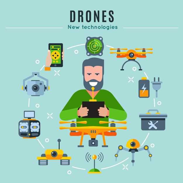
Drones en waardeketens: Voorbij de hype
Begin met een pilot van 90 dagen die het gebruik van drones koppelt aan één KPI, zoals inventarisnauwkeurigheid of snelheid van de laatste kilometer, en plan een bredere uitrol pas als de doelstelling is behaald. Definieer een duidelijke hypothese, een budget en een evaluatiefrequentie; gebruik dashboards om de voortgang in realtime te volgen en de resultaten te delen met klanten en partners.
Breng de waardeketen in kaart en kies drie concrete use cases waar drones lonen: inbound replenishment naar magazijnen, inspecties op afstand van waardevolle activa en on-site activabewaking voor onderhoudsperiodes. Stel daar datacollectiepunten vast, beoordelingscycli en verwachte payloads om ervoor te zorgen dat het plan strak blijft.
Kies voor dronevluchten met een bestuurder voor complexe locaties en autonoom voor herhaalbare routes; dit vermindert de noodzaak voor volledige automatisering vooraf en levert al vroeg ROI op. Stel veiligheidschecklists op en zorg vanaf dag één voor naleving van de regelgeving.
Bouw de infrastructuur: betrouwbare communicatieverbindingen, veilige oplaadrekken, weerbestendige planning en een datalaag die vluchtlogboeken koppelt aan ERP en dashboards. Deze basis ondersteunt zowel prestatiemeting als snel herstel na verstoringen.
Maak traceerbaarheid mogelijk met blockchains en een gemeenschappelijk datamodel, zodat gegevens van vluchten, leveringen en voorraadacties consistent blijven bij leveranciers, vervoerders en klanten. Dit verbetert bovendien de paraatheid voor terugroepacties en de transparantie van audits.
Lanceer een beknopt trainingsprogramma: 2–4 dagen voor operators, doorlopende coaching en een maandelijks veiligheids- en onderhoudsplan. Bied continue ondersteuning via een toegewijd operationeel team en duidelijke escalatiepaden, plus gedragsmonitoring om veilige, consistente praktijken te versterken in alle functies, van piloten tot managers.
Volg wat belangrijk is met dashboards die dezelfde meetgegevens voor alle belanghebbenden weergeven: doorlooptijden van verzending, drone-uptime, nauwkeurigheid van de lading en de ETA van de levering voor de klant. Communiceer resultaten regelmatig aan klanten om het vertrouwen te behouden en de samenwerking te stimuleren.
Late adopters kunnen aan momentum winnen door te beginnen met een kleine, gecontroleerde site en een nauw omschreven ROI-onderzoek, en vervolgens uit te breiden in 2-3 golven. Combineer drone-tools met vendor partnerships om de schaal te versnellen en de initiële investeringsuitgaven te beperken.
Vanuit het perspectief van de waardeketen creëren drones een pluspunt wanneer ze worden gebruikt om de nauwkeurigheid van bestellingen te verbeteren, late leveringen te verminderen en planningscycli te verkorten. Wat telt, is de discipline: plan de use cases, stem de gegevensuitwisseling af en bouw dashboards die vluchtgegevens vertalen in bruikbare beslissingen voor klanten en interne teams, met duidelijke communicatie tussen leveranciers en partners, mogelijk gemaakt door de technologie.
Inventariszichtbaarheid: real-time voorraadtellingen via luchtinspecties
Begin met een heldere business case en verzeker financiering voor een pilot die drone-gebaseerde voorraadtellingen test in één distributiecentrum. Implementeer bestuurderloze luchtvoertuigen die stellingen in kaart brengen, SKU's tellen en discrepanties in real-time signaleren, en binnen enkele minuten updates doorgeven aan het WMS, wat handmatige handelingen vermindert en personeel vrijmaakt voor waardevolle taken. Verwacht 15–25% snellere cyclustellingen en 20–30% minder telfouten in het eerste kwartaal, waardoor de beschikbaarheid in het schap en de ordernauwkeurigheid toenemen.
Zet een gecontroleerde pilot op in één faciliteit om de nauwkeurigheid te valideren ten opzichte van handmatige tellingen. Train operators en interne voorvechters via een gestructureerd programma van wekelijkse sessies van 2 uur gedurende de eerste maand, daarna driemaandelijkse opfrissers. Het programma omvat formele trainingsmodules om best practices te versterken. Definieer instellingsvensters voor vluchten tijdens perioden met lage activiteit om verstoring van het picken te minimaliseren. Voer een pilotvloot van zelfrijdende voertuigen uit en valideer de integratie met het WMS en ERP zodat tellingen automatisch naar de voorraadmodule stromen.
Het kunnen uitvoeren van vluchten buiten de piekuren vermindert de congestie en waarborgt de veiligheid. Met inzichten in cyclusnauwkeurigheid, SKU-gedrag en verouderingssignalen, kan het team de aanvullingsregels vrijwel in realtime aanpassen. Leiderschapsdashboards vatten de variantie per gangpad, per leverancier en per contractvoorwaarden samen, waardoor de waarde in één oogopslag kan worden gevolgd. De resultaten van de pilot moeten een geloofwaardige ROI aantonen om een bredere implementatie te rechtvaardigen. Een e-forum deelt de voortgang en inzichten tussen locaties, waardoor het leren en het oplossen van problemen wordt versneld.
In industrieën zoals de detailhandel, de productie, de chemische sector en de logistiek, zorgen inventarisaties vanuit de lucht voor consistent inzicht in de voorraad en een snellere reactie op veranderingen in de vraag. De aanpak kan indien nodig worden gecombineerd met RFID- of barcodescans en kan via een gedeeld datamodel worden opgeschaald naar netwerken met meerdere locaties. Het ondersteunt het bieden van continu inzicht voor fulfilment centers, cross-docks en field operations, terwijl het coördineert met vrachtwagens om inkomende en uitgaande stromen op elkaar af te stemmen.
Governance en contracten: Stel leverancierscontracten op die betrekking hebben op veiligheid, vluchtautorisatie, data-eigendom en API-toegang. Stel beveiligings- en compliance-playbooks op, inclusief privacycontroles en vluchtlogboeken. Het management zorgt voor de steun van het bestuur en budget voor een uitrol over extra locaties, en een gefaseerd plan helpt bij de uitbreiding na vooraf gedefinieerde mijlpalen. Het programma gebruikt duidelijke meetgegevens om de waarde aan te tonen voordat verder wordt opgeschaald.
Schaalbaar plan: met een bewezen ROI is het programma klaar om binnen 12 maanden op te schalen naar 30 locaties, ondersteund door een gecentraliseerd datamodel, standaard operationele procedures en een bestuursorgaan. Breid de vloot uit met een mix van voertuigen en getrainde piloten of servicepartners, en stem de financiering af op fase twee. Het resultaat is een uniform, real-time overzicht van de inventaris dat de controle in alle faciliteiten en industrieën versterkt en tegelijkertijd de coördinatie met logistieke netwerken en vrachtwagens verbetert.
Magazijnactiviteiten: verkorting van de cyclustijd met gangpadscans

Start een 12 weken durende, AI-gestuurde proef met gangpadscans in één enkel distributiecentrum om de cyclustijd met 25-35% te verkorten. Zet drones in met camera's met hoge resolutie, barcodelezers en RFID-tags om gangpaden te scannen, de aanwezigheid van voorraad te verifiëren en verkeerd geplaatste items te markeren voordat picking plaatsvindt. Een real-time feed wordt gestreamd naar het warehouse management systeem, en daar activeert het systeem waarschuwingen wanneer afwijkingen een drempel van twee vakken overschrijden.
Koppel de scangegevens aan een AI-aangedreven visionmodel dat exacte SKU's, batchnummers en vervaldatumindicatoren herkent. Dit stroomlijnt taken door pickpaden te begeleiden, slotstatussen bij te werken en handmatige hertellingen te verminderen. De power van automatische scans vermindert de reisafstand en verhoogt de doorvoer, wat leidt tot meetbare verbeteringen in de snelheid van het distributiecentrum.
In de praktijk, een case Een studie over drie vestigingen toonde aan dat de cyclustijden in de kern met 20–40% afnamen. operations. Het systeem volgt de nauwkeurigheid tot op zekere hoogte, waardoor verkeerde keuzes tot een minimaal fractie en de nauwkeurigheid van de inventaris verhoogde van 93% naar 98% binnen een kwartaal. Over meer dan een million SKU's dagelijks verwerkt, de winst neemt toe naarmate de standaardisatie zich verspreidt.
Implementatiestappen omvatten de selectie van een minimaal zone om te testen; stem de dronehardware af op uw bestaande WMS en ERP; definieer KPI-sets: cyclustijd, pick-snelheid, nauwkeurigheid, veiligheidsincidenten; plan een kalibratiefase van 6-8 weken in; train personeel; stel escalatieroutes vast voor uitzonderingen. Gebruik een enkele solution voor inkomende en uitgaande scans ter ondersteuning van stroomlijnen operations. Zorg ervoor dat de veiligheidsprotocollen het volgende omvatten: hazardous zones, en zet geofencing in om drones indien nodig uit de buurt van mensen te houden.
Datagovernance steunt op blockchains naar secures dataherkomst, waardoor audits eenvoudig worden en audit trails onveranderlijk. Dit vergroot het vertrouwen bij interne teams en externe partners. Een beveiligingslaag versleutelt telemetrie en toegangscontroles beperken de blootstelling van de operator tijdens hazardous Taken. Voer de proef uit in een speciale testomgeving om productiegegevens te beschermen.
Buiten efficiëntie, zijn er voordelen aan de aanpak society door de herhaalde belasting te verminderen en minimaal verwondingen bij magazijnmedewerkers verminderen en hen vrijmaken voor meer geschoolde taken. De AI-aangedreven solution balanceert handmatige en geautomatiseerde workflows, en ondersteunt ontwikkelen operations staff om de vaardighedenladder te beklimmen, van basis scannen tot complexe probleemoplossing. De verschuiving helpt om aan de groeiende demands and keeps distributie concurrerend in een krappe markt.
Om op te schalen, voer parallelle proeven uit in extra faciliteiten, pas routelogica aan en breid geleidelijk uit om meer SKU-families te verwerken. Overweeg een gefaseerde uitrol op basis van complexiteit; volg ROI en plan voor een implementatie in meerdere centra die een million artikelen per dag. De power van automatisering maakt het systeem gebalanceerd voor adoptie op de lange termijn, waarbij partners, van logistieke dienstverleners tot fabrikanten, hiervan profiteren solution. De aanpak blijft klaar voor blockchains integratie en coördinatie met last-mile netwerken.
Locatiebezoeken en veiligheid: bewaking van infrastructuur in moeilijk bereikbare gebieden
Implementeer een inspectieprogramma met dronepiloot en RFID-tags op activa om de structurele integriteit te verifiëren voordat grondteams de zone betreden.
Deze aanpak verkort het reizen over de weg, vermindert de blootstelling aan gevaren en versnelt de gegevensverzameling.
Drones maken dynamische beelden en thermische data vast, waardoor onderhoud in sectoren als energie, telecom en transport kan worden gestroomlijnd.
Inbraakveilige behuizingen en beveiligde datakanalen zorgen ervoor dat cruciale componenten intact blijven tijdens de inspectie, waardoor het risico op manipulatie wordt verminderd.
Gebruik RFID om activa te taggen, de status te bewaken en verkeerde plaatsingen te verminderen, terwijl geautomatiseerde waarschuwingen afwijkingen signaleren voordat ze escaleren.
Fieldteams krijgen een gevoel van veiligheid door monitoring op afstand, wat een robuust veiligheidsprogramma en strakkere controle van toegangsgebieden mogelijk maakt.
Ontwikkel een jaarlijkse opbouw van capaciteiten per sector, voortbouwend op een dynamisch risicomodel en real-time feedback van pilots en sensoren.
Dit programma dekt bovengrondse torens, wegcorridors en andere moeilijk bereikbare infrastructuur en biedt helder zicht zonder onnodige blootstelling.
Stem pilots af op regelgeving, data governance en een rol voor lokale operators in beslissingsprocessen om de waarde te maximaliseren, en zorg ervoor dat pilots, technici en managers op elkaar afgestemd blijven.
| Activa gebied | Gegevens geleverd | Operationeel voordeel | Aanbevolen Frequentie |
|---|---|---|---|
| Bruggen en torens | Hoge-resolutiebeelden, thermische kaarten | Vroegtijdige foutdetectie, minder bezoeken ter plaatse | Quarterly |
| Weg- en spoorwegcorridors | Luchtkartering, LiDAR | Verbeterde routeveiligheid, vermindert handmatige patrouilles | Halfjaarlijks |
| Pijpleidingen en zakelijke rechten | Corrosie-indicatoren, thermische anomalieën | Gericht onderhoud, verminderde uitvaltijd | Annual |
| Ondergrondse leidingen (waar toegankelijk) | 3D-modellen, sensorwaarden | Nauwkeurige lokalisatie, veiligere graafplanning | As needed |
| Moeilijk bereikbare onderstations | Live video, GPS-getagde activa | Veiligheidscontroles, snellere vergunningsvalidatie | Monthly |
Levering en haalbaarheid van de laatste kilometers: wanneer drones waarde toevoegen aan goederenstromen
Begin met een gereguleerde pilot in een afgebakende corridor, zet door bestuurders bediende drones in en gebruik realtime tracking om binnen enkele maanden tastbare winst aan te tonen.
Voor zendingen die snelheid vereisen of een hoge waarde hebben, vullen drones de routes over land aan door de overdrachtsmomenten te verkorten en de zichtbaarheid te vergroten. In de moderne netwerken van vandaag steunt deze aanpak op heldere rollen, een robuust inkoopproces en toegewijde infrastructuur om meetbare resultaten te leveren en tegelijkertijd te voldoen aan de wettelijke vereisten.
Het aanpakken van uitdagingen vereist een praktische blauwdruk: definieer het punt waarop dronevluchten waarde toevoegen, beoordeel de vraag signalen en bereid alternatieve oplossingen voor op weers- of luchtruimbeperkingen. De realiteit is dat het succes van drones afhangt van een gestage cadans van testen, data en samenwerking tussen teams die operaties, veiligheid en klantervaring beheren.
- Factoren en regelgeving: vergunningen verkrijgen, luchtruimtoestemmingen, hoogtebeperkingen en continuïteitsplannen die de verstoring van het grondverkeer minimaliseren.
- Rollen en belanghebbenden: exploitanten, vervoerders, ontvangers en toezichthouders stemmen af over wie de lading, overdrachten en uitzonderingsafhandeling beheert.
- Behoeften qua infrastructuur: grondhubs, laadstations, veilige afleverzones en beschermde routes om vertragingen te verminderen.
- Vraagsignalen: geef prioriteit aan tijdgevoelige, hoog-dringende of moeilijk bereikbare zendingen waarbij dronetrajecten de totale doorlooptijd verkorten.
- Dreigingen en veiligheid: modelleer het weer, zichtlijneisen, nachtelijke operaties en obstakeldetectie om mensen en activa te beschermen.
- Case en validatie: gebruik gecontroleerde pilots om de prestaties van drones en vrachtwagens te vergelijken over vergelijkbare routes en zendingen.
- Definieer de corridor en de dienstenomvang: selecteer stedelijke en semi-stedelijke routes met betrouwbare metadata over het luchtruim en bekende vereisten voor grondafhandeling.
- Stel prestatiedoelen vast: percentage tijdige leveringen, gemiddelde vluchttijd, benutting van laadvermogen, en latentie van real-time zichtbaarheid.
- Plan de gefaseerde uitrol: startfase met één faciliteit en een beperkt aantal zendingen, gevolgd door uitbreiding naar een andere locatie en extra SKU's over 6-12 maanden.
- Integreer met inkoop- en logistieke systemen: zorg ervoor dat order vrijgave, inventarisvlaggen en carrier overdrachten worden doorgegeven aan de drone planning.
- Stem af met infrastructuurproviders: garandeer laadcapaciteit, veilige landingszones, en noodroutes bij storingen.
- Monitor gedrag en aanpassing: volg afwijkingen, incidentenrapporten, signalen van klanttevredenheid en operationele knelpunten op om snel bij te sturen.
In een regionale casestudy combineerde een productienetwerk dronevluchten voor dringende monsters met door chauffeurs geleide routes voor bulkzendingen. Het resultaat: een verminderde reistijd voor prioritaire zendingen, een verbeterde voorspelbaarheid en lagere handlingkosten. Een andere sector wees op soepelere inkoopcycli, aangezien realtime statusupdates proactieve afwijkingen mogelijk maakten, waardoor gemiste leveringen en retourzendingen werden verminderd.
Wat te meten om waarde te valideren:
- Servicelevel voor tijdskritische zendingen en de gemiddelde afstand bespaard per dronevlucht.
- Doorvoercapaciteit per uur en per route, rekening houdend met laad- en overdrachtstijden.
- Naleving van regelgeving, veiligheidsincidenten en effectiviteit van bedreigingsmitigatie.
- Klantbeleving statistieken gekoppeld aan bezorgvensters voor de laatste mijl en nauwkeurigheid van meldingen.
- Kosten per geleverd stuk vergeleken met traditionele workflows uitsluitend via grondtransport, inclusief inkoop en kapitaaluitgaven voor infrastructuur.
Tip voor operators: begin klein, documenteer de impact over verschillende verzendprofielen en gebruik die bevindingen om routing- en laadplanningsstrategieën te verfijnen. Door dronevluchten af te stemmen op grondtransport, wint het netwerk aan veerkracht, terwijl teams leren om op een gecoördineerde manier in te spelen op de realiteit van wettelijke controle en klantverwachtingen. Deze aanpak helpt organisaties om hun activiteiten te stroomlijnen, de variabiliteit te verminderen en nieuwe waarde te ontsluiten over meerdere werelden van vrachtstromen.
Gegevenskwaliteit en Compliance: Verificatie van Records en Vermindering van Audit Gaps
Neem een gecentraliseerde datavalidatieworkflow aan die automatisch anomalieën markeert tijdens de data-invoer van drones. Valideer rond vluchtlogboeken, beeldmetadata en sensorgegevens over taken en verifieer records voordat ze het datapakket binnenkomen. Implementeer controles op drie niveaus: invoer, verwerking en kwaliteitscontrole. Deze aanpak levert snellere reconciliatie op, waardoor auditkloven aanzienlijk worden verminderd en de beste oplossing wordt geboden die complexe dataflows gemakkelijker te beheren maakt. Het creëert een duidelijk pad voor teams die ernaar streven om doelen te bereiken en proeven en casodemonstraties te implementeren.
Naleving hangt af van verifieerbare herkomst en consistente records gedurende de gehele levenscyclus van de data. Creëer een volledig audit trail met versiebeheerde datapakketten, tijdstempels en digitale handtekeningen om auditing over afdelingen te vergemakkelijken. Stem bewaarderings- en privacycontroles af op regionale regels, met name voor grensoverschrijdende data, en documenteer elke wijziging om risico te verminderen in het geval van een extern verzoek. Door metadata te consolideren in een enkel, manipulatiebestendig pakket, minimaliseert u het risico op ontbrekende records en sluit u hiaten die vaak voorkomen bij handmatige controles.
Operationele teams kunnen gebruikmaken van geautomatiseerde workflows om de gegevensstroom van het veld naar de cloud te stroomlijnen, met dashboards die nauwkeurigheid, volledigheid en naleving in bijna realtime volgen. Focus op die gegevenspunten die besluitvorming stimuleren: vluchtlogboeken, batterijcycli, precisietijdstempels, geotags en sensorkalibraties. Gebruik een op standaarden gebaseerd schema om interoperabiliteit tussen leveranciers en drones te ondersteunen, en houd van dichtbij toezicht op beperkingen zoals ontbrekende metadata of inconsistente eenheden. De kracht van automatisering verplaatst die repetitieve taken weg van mensen en versnelt de besluitvorming, waardoor snellere, betrouwbaardere resultaten mogelijk worden. Deze aanpak ondersteunt stroomlijning over verschillende databronnen en levert een sterkere, snellere, veerkrachtigere pijplijn op die herbewerking vermindert en de in audits gebruikte bewijsvoering versterkt.
Roadmap stappen omvatten het definiëren van datakwaliteitsdoelen, het opzetten van een pilotprogramma over meerdere locaties en het toewijzen van personeel voor governance. Verpak data met duidelijke versiebeheer, automatiseer controles en plan driemaandelijkse audits om lacunes te dichten voordat ze tot blootstelling worden. Omarm opkomende datatypes, zoals multispectrale beelden of payload-telemetrie, en bouw een flexibele weg die schaalt rond operaties, regelgevende instanties en partner ecosystemen over de hele wereld.